
When I turned sixteen and obtained my driver’s license my mother gave me two gifts that I treasured at the time, and upon which I look back with great fondness now: a AAA membership and a Thomas Brothers Popular Street Atlas for Los Angeles County, my hood.
Today I have Apple Maps and Siri telling me where to go, but back in the day the amazing “Tommy Guide” was the map of choice and no Southern California driver worth his or her street signs would go anywhere without one. This driver apparently still feels that way. Speaking of which, who will be first to ID what sort of car this is?
Last Call indicates the end of Hooniverse’s broadcast day. It’s meant to be an open forum for anyone and anything. Thread jacking is not only accepted, it’s encouraged.
Image: ©2017 Hooniverse/Robert Emslie, All Rights Reserved
Last Call: Navigation System Edition
About
17 responses to “Last Call: Navigation System Edition”
-
Based on the engine intrusion into the cabin, and the location of the steering wheel, it’s either an imported classic van, or a classic postal van.
Based on the word “Queen’s” on the paper in the glove-box, I’m guessing that it’s a late 1940’s-early 1950’s British van.
Beyond pointing out the obvious, and guessing wildly, however, I have no idea what it could…
Let’s see if the rest of the ‘Verse can prove my guess right or wrong!
-
I still don’t leave San Francisco without my Thomas Guide.
I’m out of ideas about that vehicle. The steering column is raked like a long-hood vehicle, but there’s that doghouse. Front-hinged doors rather than sliders. The dash didn’t match any searches I did on Bedford vans or other English types, or Jeep and IH, or Citroen.
Use your browser to zoom in on that steering wheel center, see if you recognize it. The door and horn button are sort of Bleu de France colored, French? -
I’m currently on a road trip and my Garmin is fine if I want to get some place specific. But general road trip planning sucks. Google is a little better, but it’s not perfect. Especially out in West Texas there is no signal for squat. I have a book on Route 66 but it’s proving to be mostly useless as well. So much can change in a few years. Fortuantly I have plenty of time and have taken to winging it.
-
my oldest street directory is a 1928 and I still use it when i’m going inner city, its smaller than my mobile phone and a lot easier to use than the maps function
though it must be said there are quite a lot of streets that don’t seem to exist anymore
I’ve also got a collection of not as old streetmap books (roughly one for every 10 years since the oldest) and was given a 2015 edition the other day which has replaced the 1987 currently keeping the door pocket full in the rodeo -
my experience with navigation in Montana’s outback was this: move in a straight line to a stream. walk downstream. eventually one arrives at the the Missouri river. after that, it gets easier.
my first experience in oceanic and aviation related navigation was called “dead reconning” . i informed my instructors that i had misgivings. (see Montana) i was then instructed in celestial navigation. a whole different can of worms. sextants and chronometers. loran, omega. inertial systems. oh, the wonders.
maps are a useful thing to have. gps with dead batteries not so much. knowing the sun usually rises in the east and sets in the west and that at noon you should take a break is also useful to know.
lots of people driving now days use the “lemming” system,,,,follow the one in front. -
Mharrell fully approves of this installation. In fact, I’d be quite surprised if he didn’t invent it.
-
I recon it’s a Reliant Robin or similar three wheeler…
There is an engine and front wheel under there!
Edit: It’s a Reliant Regal!
https://rustybuttrusty.files.wordpress.com/2013/10/1972-reliant-regal-interior.jpg-
Yep, tippy canoe and tyler too!
-
Yeah, I’m late to the party but the combo of RHD, doghouse and Bond Bug speedometer made it some sort of 3 wheel Reliant.
-
The Reliants are actually rear-wheel drive. Well spotted though! I was wondering if it was one of the BMC vans.
-
-
I love paper maps, but not even close to the degree that my eldest son does. His birthday and X-mas wishes seem to always include an atlas.
Also, living in such a rural location and refusing to adapt to modern technology with a phone – coupled with spotty cell reception for those who do, every single one of our vehicles is equipped with this:http://cdn6.bigcommerce.com/s-yqkp4d/products/4134/images/6126/0899333338_1__24409.1452106151.500.500.jpg?c=2-
those atlases KICK ASS!
-
-
How could we go from this tiny, close to cute snout:
https://upload.wikimedia.org/wikipedia/commons/1/1e/Volvo_V70_front_20080801.jpg
to this “I CAN HAZ RECOGNITION” kisser, that really doesn’t benefit from the WW2 air-raid safe DRL?
http://uploads.haystak.com/LPs/Volvo_of_Midlothian/01496799_DealerProvidedS90_Img/Images/S90-2a.jpg -
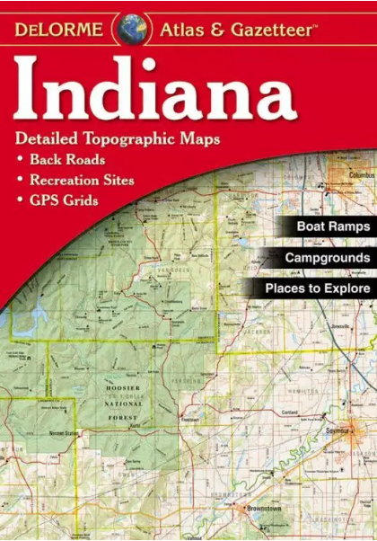
For me, it was a Delorme “Atlas and Gazetteer”. Maps down to the county roads. Loved that thing, and still have one. But I haven’t updated in years, because frankly, why would I? GPS (running from my smartphone) and Google Maps on my computer have replaced the paper map for me.
https://uploads.disquscdn.com/images/b7078e0a424e1d07d484a17377b24150e2eaac377f76db9ef01833dd1ea0ebb3.png-
deLorme headquarters in Maine has the absolute neatest globe on display. go visit. great vacation by-road destination on the way to Barr Harbor.
-
Great Falls Construction awarded contract with DeLorme to help repair World’s Largest Globe
Ah, the world’s largest rotating globe. Looks nice.
-
-
-
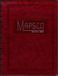
Here in the DFW, the go-to guide was the Mapsco. Mapsco was started by a Dallas florist – he got tired of his delivery drivers getting lost:
https://en.wikipedia.org/wiki/Mapsco
I still have a few (I bought my first in 1979); I even bought one of the reprinted 1952 Mapscos (their first edition):
https://upload.wikimedia.org/wikipedia/commons/thumb/a/ab/52Book.jpg/200px-52Book.jpg
Leave a Reply